Shropshire Maps Guide: Walking Routes, Interactive Maps & Attractions (Free PDFs)

LOOKING FOR DOWNLOADABLE SHROPSHIRE MAPS AND GUIDES?
The stunning county of Shropshire stretches across the Welsh border, forming part of England’s magnificent western frontier.
As one of Britain’s most captivating rural destinations, I’ve ventured to this enchanting borderland countryside on numerous occasions, and I’ve now gathered together a selection of the finest free, downloadable PDF maps of Shropshire.
PLAN YOUR TRIP WITH OUR FAVOURITE RESOURCES
→ Best Accommodation site: Booking.com
→ Book an Activity or a Day Tour here: Viator.com
→ Compare Bus, Coach & Train Prices here: Omio.com
→ Reserve your Rental Car here: DiscoverCars.com
Why You Need a Specialised Shropshire Map
The Shropshire Hills National Landscape (formerly AONB) encompasses 310 square miles of dramatic hills, ancient valleys, and market towns scattered across this border county.
This Area of Outstanding Natural Beauty showcases some of England’s most distinctive upland scenery, from the iconic Long Mynd to the volcanic Wrekin. Mobile coverage is often patchy in these remote hill areas, so having a proper map is vital for thorough exploration.
The landscape is remarkably diverse – from the heather-covered plateaux of Stiperstones to the gentle river valleys around Church Stretton. The OS Maps App reveals essential information including ancient drove roads, hill tracks, and contour details that standard smartphone maps simply cannot provide. There are also numerous Sites of Special Scientific Interest, like the unique quartzite ridge of Stiperstones, which supports rare montane flora.
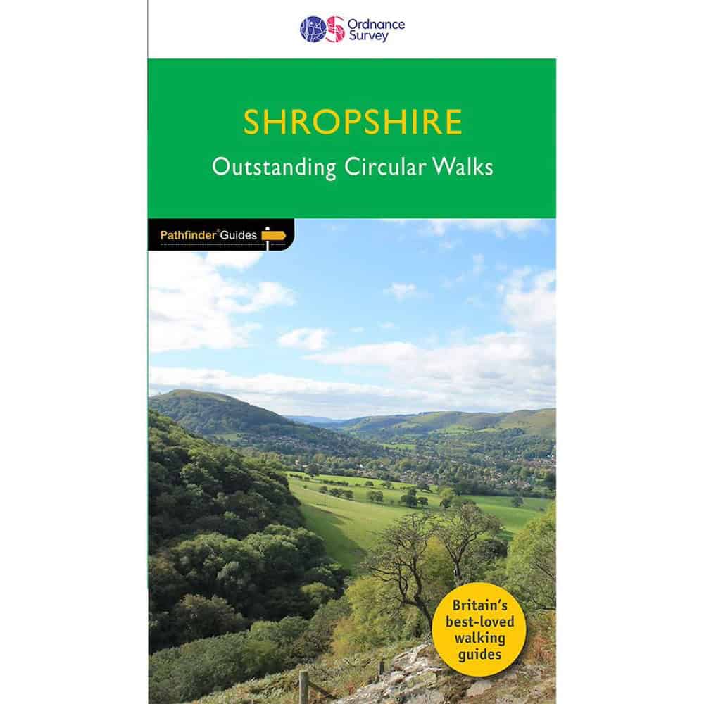
→ Get 50% Off the OS Maps App Here → Buy OS Pathfinder Guide Here
Interactive Map of Shropshire
This comprehensive Google map covers key attractions across the county of Shropshire:
★ Historic sites including Ludlow Castle and the Iron Bridge at Ironbridge Gorge
★ Wildlife havens such as Stiperstones National Nature Reserve
★ Population centres (Shrewsbury, Telford) alongside charming market towns
★ Walking paths connecting quintessential border villages
Related post: Shrewsbury Maps [Free PDF Downloads]
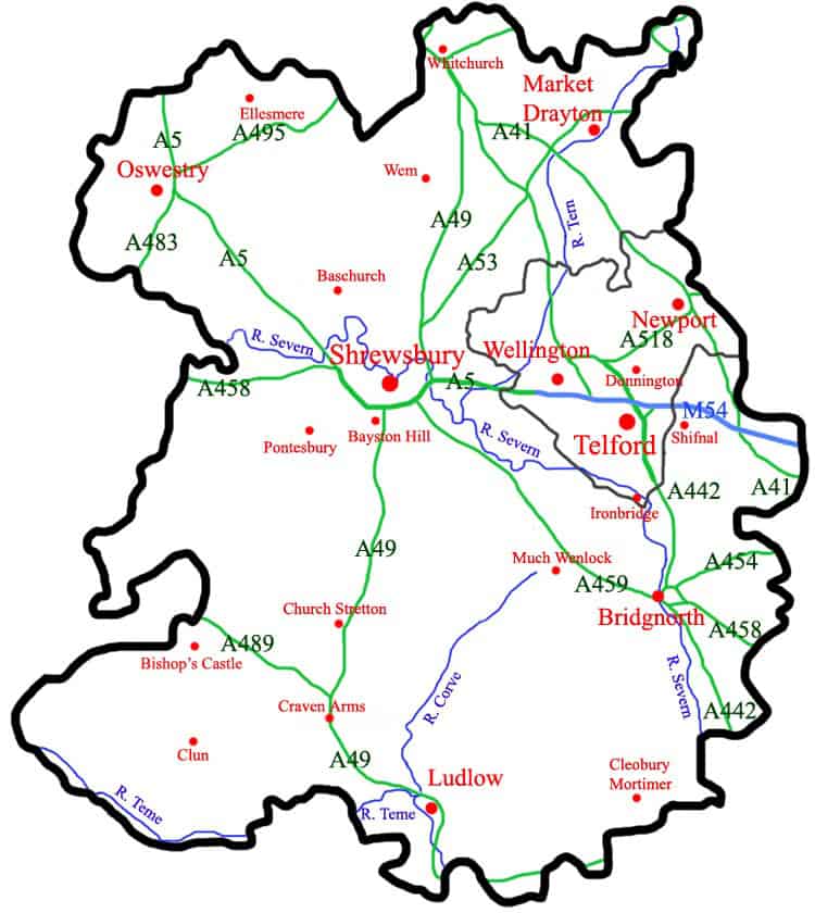
Road Map of Shropshire County
A modern road map of Shropshire, England, highlighting main towns like Ludlow, Telford, Shifnal, and Oswestry, with major routes (A49, A458) and the Rivers Teme, Corve and Severn.
➤ Download the Shropshire County PDF map here.
Driving through Shropshire?
Driving is easily the best and most convenient way to get around Shropshire, due to the large size of the region, and the poor public transport network in many of the rural towns and villages of the region.
If you don’t have your own car, your best bet is to hire a rental car – we recommend DiscoverCars for their transparency and positive reviews.
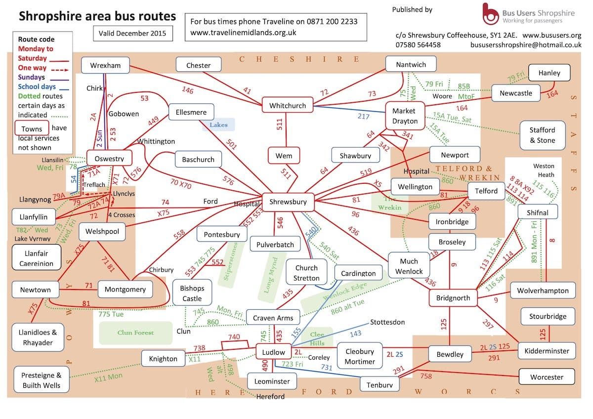
Shropshire Bus Routes Map
A useful, visual word map of Shropshire’s bus network centered around Shrewsbury (the county capital), with labelled boxes indicating place names, linked up by red lines, and green boxes of nature spots.
➤ Download the Shropshire bus routes map PDF here.
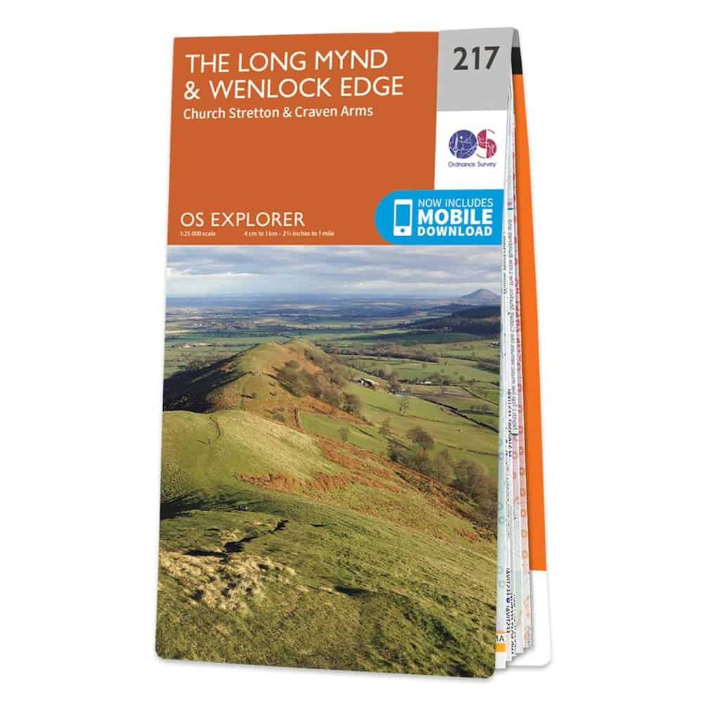
OS Explorer Map: X (OL45)
The gold standard for serious walking, this Shropshire Walking Guidebook provides unmatched detail.
★ Trails perfect for cyclists and equestrians across the hills
★ Terrain contours essential for conquering the Shropshire Way
★ Nature reserves including Long Mynd (Special Scientific Interest)
★ Historic sites clearly marked along all principal walking routes
→ Buy your OS Pathfnder Guide Here ← | → Try OS Maps App 50% Off ←
★ Fancy a guided tour of Shropshire’s popular attractions?
Here are some of our recommended guided tours of the most popular activities in Shropshire:
➤ Shrewsbury Prison guided tour and museum access led by a prison officer
➤ Go on a quirky trek of the Shropshire Hills with the world’s smallest sheep
➤ Take a guided walking tour of the Ironbridge Gorge UNESCO World Heritage site with a Victorian professor at the birthplace of the Industrial Revolution
Read more: 10 Top Family-Friendly Day Trips from Birmingham
Map of the Shropshire Way
The Shropshire Way begins at the striking Buzzard Sculpture on Kingsland Bridge, weaving through the county in a scenic “figure of eight” loop with Shrewsbury at its heart. The route is divided into northern and southern sections, each broken into manageable day-long stages—though walkers can adjust these based on their preferred distance and stamina.
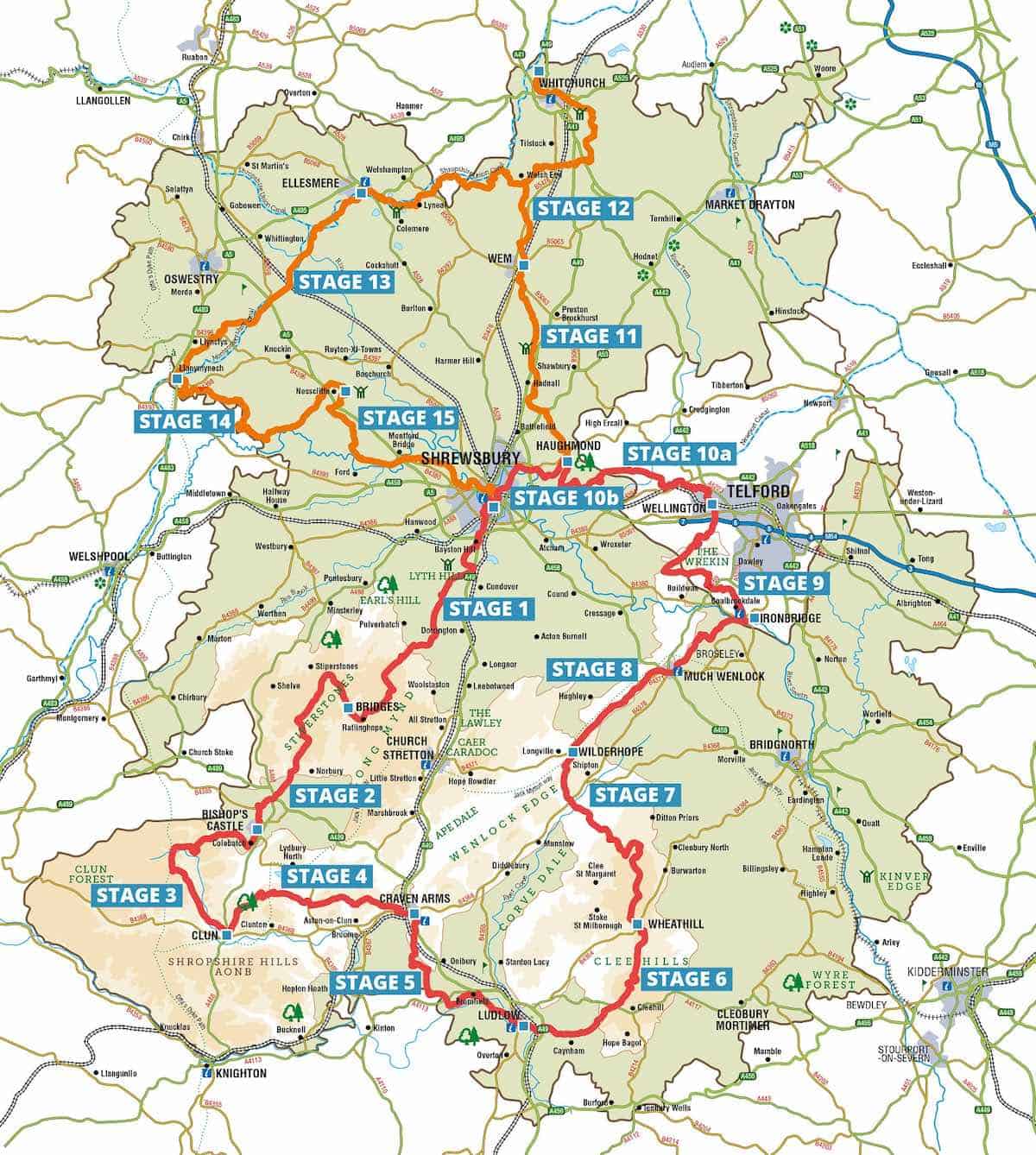
The southern loop (in red) follows a circular path from Shrewsbury and back. This leg takes hikers through the dramatic landscapes of the Shropshire Hills, from the rugged Stiperstones to the rolling Clee Hills and the limestone escarpment of Wenlock Edge.
The northern section (in orange) leads walkers past serene canals, expansive meres, and the unique wetland landscapes of the Shropshire Mosses. This area is a haven for wildlife, particularly birdlife and rare plant species.
➤ Download the Shropshire Way PDF map here.
My Trusted Travel Gear for Shropshire Trekking and Camping
Here’s a list of my most trusted travel gear that I’ve used in more than a decade of travel around the UK as well as abroad. I highly recommend these items for your time in Shropshire – whether for walking, hiking or camping:
✅ Lifestraw Filter Water Bottle: Our go-to travel essential—it filters any water source to pure, clean drinking water while saving money and reducing plastic waste.
✅ Mens / Womens Patagonia Jackets: Versatile all-weather windbreakers that stay cool in summer and layer well in winter, combining style, comfort, and durability.
✅ Osprey Backpack: After a decade of testing, the 65L Osprey remains our top pick for reliability and longevity—worth the investment.
✅ Camping Essentials: Start with three basics—a budget-friendly tent (£99+), a sleeping bag, and a torch (£4+)—then add extras like a stove or chairs.
✅ Salomon Boots: Perfect for hikes or town walks, offering durability and comfort without bulk.
Accommodation Map: Best Places to Stay in Shropshire
Finding the right accommodation ensures a comfortable base for exploring. Here are our top Shropshire recommendations to suit all budget ranges:
◉ Luxury: The Barley Store (Craven Arms), a spacious 5-star apartment with all of the amenities – Exceptional 9.7☆
◉ Budget: The Topsy Turvy Gardeners Cottage (Ludlow), a fantastic 1-bed apartment at an absolute bargain in the UK’s foodie capital – Exceptional 9.7☆
Fancy Glamping in the Shropshire Hills?
If you’re after something special, I recommend staying in a luxury glamping pod at Mountain Edge for a truly unique experience and fantastic way to enjoy the stunning Shropshire Hills while still having all the comforts of home – cosy beds, wood burners, and incredible starry skies! Click below for discounted deals:
You may also like: English Heritage or National Trust [Comparison Guide]
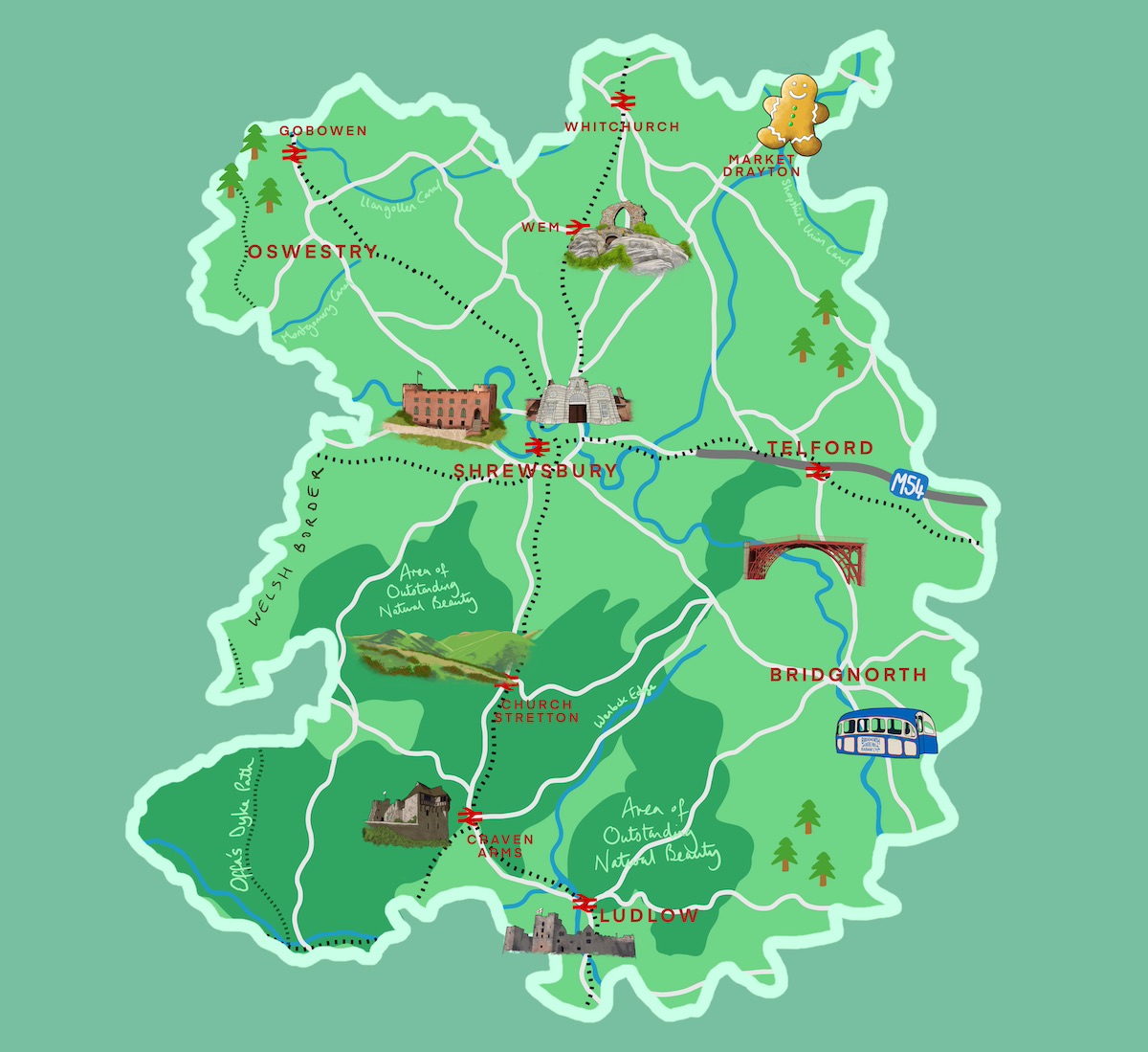
Illustrated Map of Shropshire
Here’s a brightly-coloured illustrated map of Shropshire I created, depicting iconic landmarks like the Iron Bridge, a gingerbread man, Ludlow Castle, Shrewsbury Prison and Castle, Stokesay Castle, the Long Mynd hills, and the Bridgnorth cable car, as well as main road routes, canals, railway lines, rivers, trees and countryside areas.
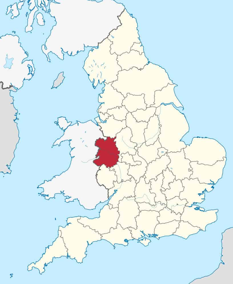
Shropshire Locator Map in England
Here we have a map of the UK with its country and county borders, and on England you can see the county of Shropshire highlighted in dark red.
➤ You can download the Shropshire Locator Map PDF here.
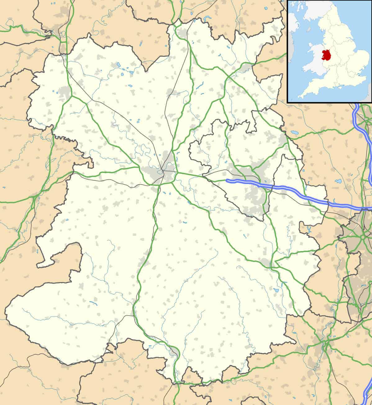
Shropshire County Location Map in England
This map outlines Shropshire county in the West Midlands and details main road routes in green and other roads in grey, rivers, highlighted urban areas and the motorway the ends just west of Telford.
➤ You can download the Shropshire County Map PDF here.
See also: The Best Time to Visit the West Midlands [Insider Guide]
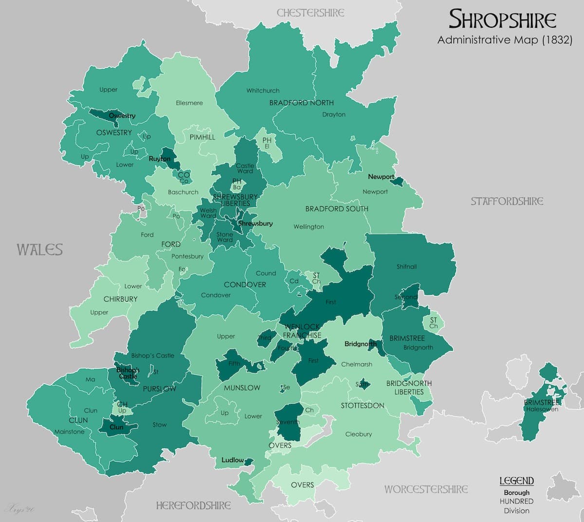
Vintage 1832 Map of Shropshire
Next is an administrative map of Shropshire county from 1832, with different shades of green highlighted areas and regions within Shropshire then known as the “historical hundreds”, with many former names of regions, towns and villages that are no longer in use today. Telford, the county’s most populous town, doesn’t exist as it’s a modern town that hadn’t yet been established.
➤ Download the Vintage Shropshire 1832 Map PDF here.
→ Related: more Maps posts:
Birmingham Maps [+ Travel Guides, Brochures]
Maps of The 6 Towns of Stoke-on-Trent [Free PDFs]
West Midlands County Maps (Free PDFs)
Free Coventry Maps (PDF Downloads)
Cotswolds Maps: Interactive, Downloadable Free PDFs
Warwickshire & Warwick Maps (Free PDF Downloads)
15 Peak District Maps (Free PDF Downloads)
Staffordshire Maps – Free Downloadable PDFs
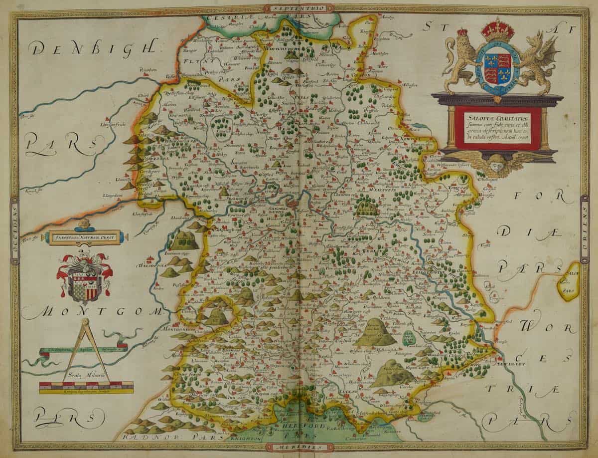
Vintage Salopia Atlas
A vintage map of Shropshire county dated from medieval times, named “Salopia” – the former, medieval name of Shropshire. A yellow border outlines the county, geographical images and crests surround the map, while featured in the map are intricate detailed illustrations of hills, rivers, roads and markers of old place names.
➤ Download the Vintage Salopia Atlas PDF here.
Related: 26+ Kid-Friendly Things to Do in Shropshire
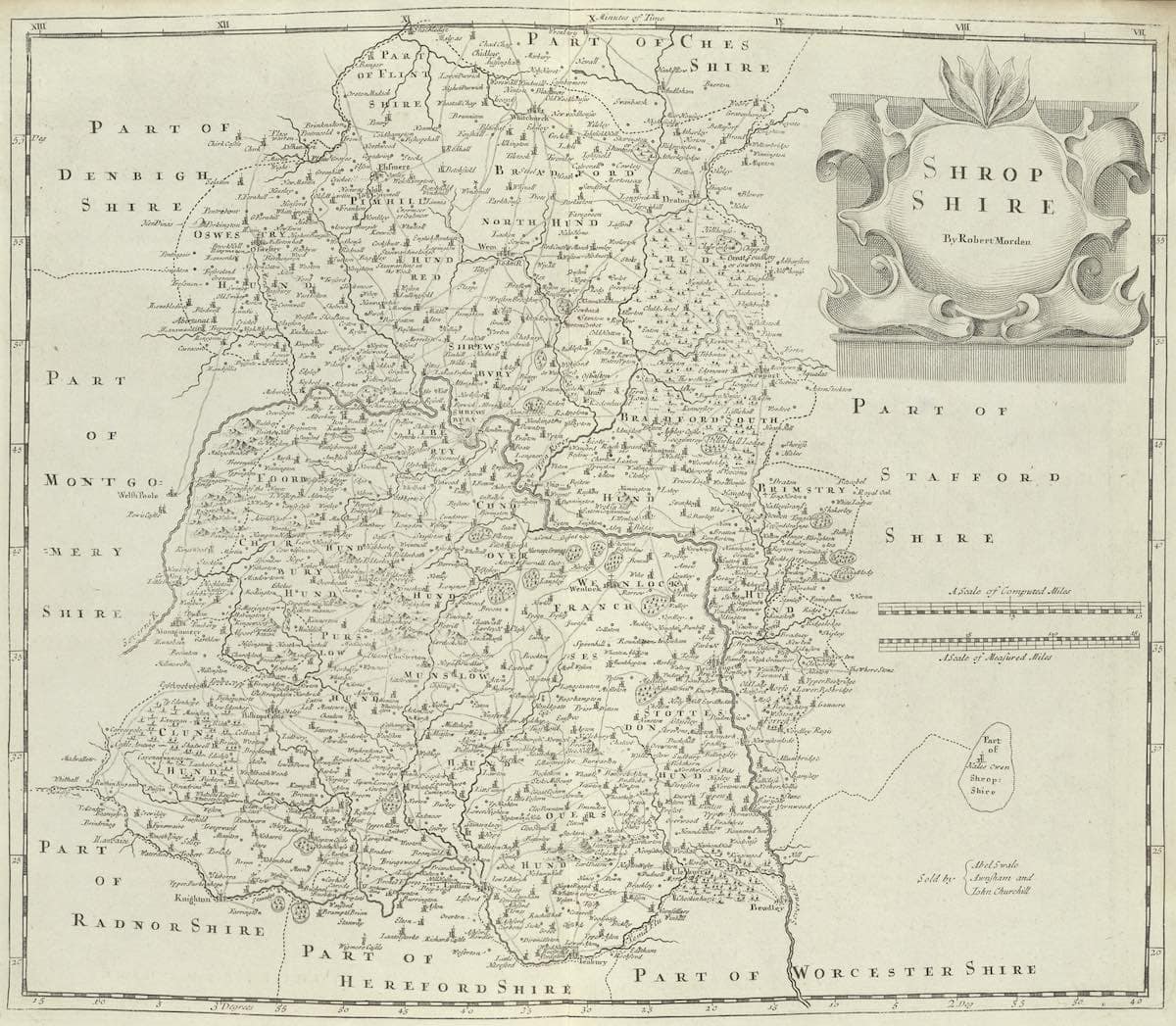
Vintage Map of Shropshire by Morden, circa 1695
Another vintage detailed map of Shropshire county by Robert Morden from 1695, with very fine detail of rivers trees and hills, old road routes, former boundary lines (including a different Welsh/English border line from that time period) and former names of towns and villages, some of which are still in use today.
➤ Download the Vintage Shropshire Morden Map 1695 PDF here.
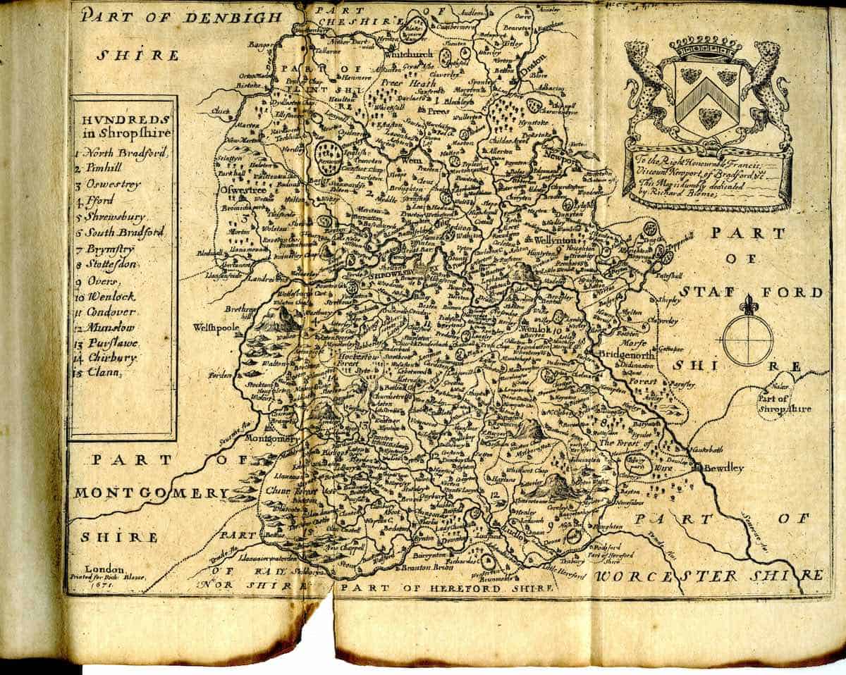
Vintage 1671 Map of Shropshire
Historical 1671 map of Shropshire, England, listing the Hundreds (administrative divisions before they became known as modern districts) such as North Bradford, Hanhill, and Clun, with bordering regions like Denbighshire and Herefordshire.
➤ Download the Vintage 1671 Shropshire Map PDF here.
See also: The Wrekin: Shropshire’s Underrated Peak (+ Walking Maps)
Satellite view of Shropshire (Google Maps)
Here is an interactive satellite map of the Shropshire region on Google Maps. You can scroll around the map and zoom in to see a 3D view of the towns and villages, along with landmarks, nature spots and attractions that you can click on and discover more information about.
General Information about Shropshire
Area: 1,347 square miles (3,488 km²) – England’s largest inland county
Name origins: Derives from Scrobbesbyrigscīr (Old English for “Shrewsbury’s county”), linked to its historic heart.
Weather: 2°C lowest (winter), 24°C highest (summer)
Population: 498,073 (2022)
Highest Peak: Brown Clee Hill (540m)
Largest Lake: Colemere Lake (120 acres)
Unique Features: Timber-framed Tudor buildings in Shrewsbury, the UNESCO-listed Ironbridge Gorge (Birthplace of Industry), and the dramatic quartzite ridge of The Stiperstones.
Hidden gems: Stokesay Castle (England’s best-preserved medieval fortified manor), The Bog Visitor Centre (mystical Fenn’s, Whixall & Bettisfield Mosses), Ludlow’s Medieval Streets (home to Britain’s first Michelin-starred pub, The Harp).
Famous Residents: Chalres Darwin, Wilfred Owen, Howard Carter, Mary Webb (author), Clive Owen (actor), Matthew Corbett (Sooty Show, Shrewsbury)
Further reading: The 10 Best Paddle Boarding Spots in the West Midlands
What is the nicest village in Shropshire?
Shropshire boasts many picturesque villages, but Ludlow stands out for its medieval charm, award-winning food scene, and stunning castle. Alternatively, Much Wenlock offers historic Olympic connections and quaint timber-framed buildings, while Church Stretton is a gateway to the scenic Long Mynd hills. Each village has unique appeal, from Ludlow’s gourmet reputation to Much Wenlock’s heritage.
What is Shropshire famous for?
Shropshire is renowned as the birthplace of the Industrial Revolution, home to the UNESCO-listed Ironbridge Gorge and the world’s first iron bridge. It’s also celebrated for its stunning landscapes, including the Shropshire Hills AONB, and historic market towns like Shrewsbury (Darwin’s birthplace) and Ludlow (a foodie hotspot).
What is the iconic hill in Shropshire?
The Wrekin (407m) is Shropshire’s most iconic hill, visible for miles and crowned with an Iron Age hillfort. For the highest peak, Brown Clee Hill (540m) offers panoramic views, while the rugged Stiperstones ridge is famed for its quartzite tors and folklore. All are prime hiking destinations.
Final Tips for Your Shropshire Trip
✅ Purchase a laminated OS Explorer Map if you plan serious walking – the weather can change quickly in this landscape.
✅ The OS Maps App (50% off here) provides excellent real-time directions across all trails with the location of most popular and hidden gem attractions
✅ Respect the wildlife – stick to marked trails and rely on the Countryside Code.
✅ Consider visiting in shoulder seasons (April-May or September-October) to avoid crowds.
✅ Combine your trip with visits to nearby regions like Wales or Staffordshire for extended exploration.
More Shropshire Articles:
14 Best Places to Eat in Ironbridge
Must-Visit Market Towns in Shropshire
Discover Historic Wem, Shropshire
Broseley: Lesser-Known Gateway to the Ironbridge Gorge
Discover Market Drayton: Home of the Gingerbread Man
Shifnal – Shropshire’s Underrated Gem
Whitchurch: Shropshire’s Oldest Settlement (Guide)