Map of Stoke-on-Trent: Six Towns Tourist & Travel Maps [Free PDFs]

LOOKING FOR DOWNLOADABLE STOKE MAPS AND GUIDES?
As a lifelong resident of Stoke-on-Trent, I’ve compiled this essential collection of FREE printable maps to help visitors and locals explore our historic Potteries region.
These Ordnance Survey-backed resources provide a wealth of information covering everything from modern roads to Victorian heritage sites.
Why Our Maps Stand Out:
✔️ Official Ordnance Survey data
✔️ Optimised for fast loading
✔️ Perfect for walking tours and cyclists
✔️ Covers all six towns in the area
PLAN YOUR TRIP WITH OUR FAVOURITE RESOURCES
→ Best Accommodation site: Booking.com
→ Book an Activity or a Day Tour here: Viator.com
→ Compare Bus, Coach & Train Prices here: Omio.com
→ Reserve your Rental Car here: DiscoverCars.com
Why You Need a Specialised Map of Stoke & Beyond
Stoke-on-Trent sits near the Peak District, offering rugged landscapes like the Roaches, scenic trails such as the Staffordshire Way, and the Trent & Mersey Canal. With patchy phone signal in rural areas, a detailed OS Explorer Map (OL24 or OL1) is essential for exploring safely.
The terrain varies from rocky ridges (home to peregrine falcons) to gentle canal paths. Protected sites like the Roaches SSSI and Dovedale’s limestone valleys require careful navigation—something smartphone maps often miss.
Pro Tip: A waterproof OS Explorer Map (or the OS Maps App) ensures you won’t miss hidden gems, like Manifold Valley’s waterfalls or wildflower meadows along the Staffordshire Way.
→ Get 50% Off the OS Maps App Here ← | → Buy Paper OS Maps Here ←
This post covers a variety of detailed and informative travel and tourism maps and guides, illustrated maps, and even vintage maps.
Interactive Map: Stoke-on-Trent
Explore the most popular attractions across our federation of towns with this quick loading virtual map, including:
→ Stoke Minster
→ The iconic Potteries Museum
→ Trentham Gardens
You may also like: 15+ Maps & Guides of the Peak District (Free PDFs)
Illustrated Map: Stoke Icons & Landmarks
Here’s an illustrated visual map of Stoke on Trent that I created, featuring main roads and canals, and some iconic landmarks, providing a visual guide of the city in general.

Further reading: Best Time to Visit West Midlands [Local’s Guide]
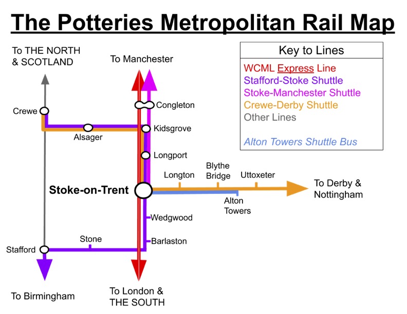
Rail Map of Stoke-on-Trent
This colour-coded map shows all train services connecting:
→ Stoke-on-Trent Station (main site)
→ Longport
→ Kidsgrove
★ Pro Tip: Visit stations in order from north to south for a scenic tour.
Download the Potteries Rail Map PDF here.
Detailed Road Map of Stoke on Trent
Our Ordnance Survey street map features:
→ Key services and amenities
→ Trails for walkers and cyclists
→ All major roads (A-roads highlighted)
→ The city centre layout

Download the Ordnance Survey Map of Stoke Centre PDF here.
Driving around Stoke-on-Trent?
The best way to get around this region is by car for flexibility, comfort, speed, and the plenty of affordable (and often free) parking spaces. If you don’t have your own, we recommend renting a car. Our go to site is DiscoverCars – we’ve used them at home and abroad for years, and we like their transparency, great reviews, and easy-to-use site.
Did you know: The six towns of Stoke united to form a federation in 1910 and was granted city status in 1925? For more Stoke facts, here’s 41+ Incredible Facts about Stoke You Probably Didn’t Know.
OS Explorer Map: Stoke-on-Trent (258)
The gold standard for serious walking, this OS Explorer Map provides unmatched detail.
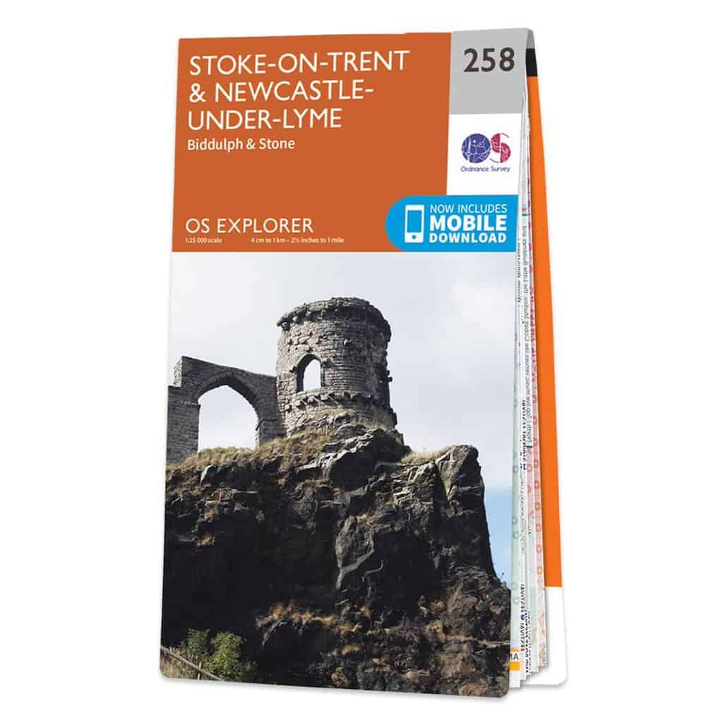

★ Multi-use trails suitable for cyclists, walkers, and horse riders along the Staffordshire Way and Trent & Mersey Towpath
★ Terrain gradients essential for navigating the Roaches and Peak District foothills
★ Nature reserves including the Roaches SSSI and Dovedale’s limestone valleys
★ Historic pottery sites and industrial heritage landmarks marked along key walking routes
My Trusted Travel Gear for Trekking and Camping
Here’s a list of my most trusted travel gear that I’ve used in more than a decade of travel around the UK as well as abroad. I highly recommend these items for exploring Stoke’s countryside – whether for walking, hiking or camping:
✅ Lifestraw Filter Water Bottle: Our go-to travel essential—it filters any water source to pure, clean drinking water while saving money and reducing plastic waste.
✅ Mens / Womens Patagonia Jackets: Versatile all-weather windbreakers that stay cool in summer and layer well in winter, combining style, comfort, and durability.
✅ Osprey Backpack: After a decade of testing, the 65L Osprey remains our top pick for reliability and longevity—worth the investment.
✅ Camping Essentials: Start with three basics—a budget-friendly tent (£99+), a sleeping bag, and a torch (£4+)—then add extras like a stove or chairs.
✅ Salomon Boots: Perfect for hikes or city walks, offering durability and comfort without bulk.
Related post: Staffordshire Maps – (Free Downloadable PDFs)
Tourism Maps of Stoke
Here are seven detailed information maps showing cultural attractions, factory shops and coach parking facilities around the city.


All of the above walking maps are on the complete PDF guide here which you can download, and also features general information and contact details for each attraction.
Related: more West Midlands Maps posts:
Birmingham Maps [+ Travel Guides, Brochures]
Maps of the West Midlands (Free Downloadable PDFs)
Downloadable PDF Maps of the Cotswolds AONB
Coventry Free Maps (Downloadable PDFs)
Maps of Shrewsbury Town (Free PDFs)
Collection of Free Shropshire Maps [PDF Downloads]
Maps of Warwick & Warwickshire (Free PDF Downloads)
Accommodation Map: Best Places to Stay in Stoke
Finding the right accommodation ensures a comfortable base for exploring this region. Here are our top Stoke-on-Trent recommendations to suit all budget ranges:
Street Map of Stoke-upon-Trent
A modern street map of the centre of Stoke-upon-Trent town, showing major roads, buildings and other information.

Download this OSD Street Map of Stoke here.
Vintage Map of the Six Towns of Stoke
Step back in time with this 19th century map showing:
→ Historic roads and boundaries
→ How the area developed
→ Original Potteries locations
Download the vintage Stoke map PDF here.

You may also like: Royal Market Towns in Staffordshire
Satellite view of Stoke on Trent (Google Maps)
You can scroll around this interactive map and zoom in to see a 3D view of the city, along with landmarks and places of interest that you can click on to discover more.
Six Towns of Stoke Map (Modern)
Here is a modern map of Staffordshire displaying the six towns of Stoke on Trent in red markers with a black outline of the official city borders.
Download the Six Towns of Stoke on Trent Map here.

Popular Stoke-on-Trent articles:
Where to Go Pumpkin Picking Around Stoke
15 Incredible Places to Eat in Stoke-on-Trent
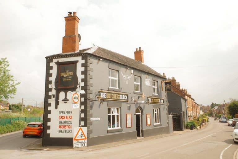
Map of the Best Pubs in Stoke-on-Trent
I compiled this map of the best, award-winning, real ale public houses around Stoke. Zoom in to see their locations, and check out my guide on Stoke’s best pubs here.
Map of Hanley in 1800
A fascinating historical map of Hanley in 1800, showing various streets, landmarks, and businesses.

The oldest map on the list, it includes potteries, chapels, and residences of prominent individuals.
Download the vintage Hanley Map PDF here.
Further reading: Stone, Staffordshire: History, Facts, Things to Do
ST Postcodes Map
Navigate the UK’s unique postal system specifically the ST postal code, with this guide to:
→ Services in each area
→ ST1 to ST21 districts
→ Nearby cities and towns

Download the ST Postcode Map PDF here.
Further reading: Top Free Activities & Attractions in the West Midlands
What are the 5 towns of Stoke on the Trent map?
The 5 towns Stoke on Trent is typically referred to are Hanley, Burslem, Tunstall, Longton, and Stoke-upon-Trent. These towns, along with Fenton, form the core of the city. Each has its own distinct character and history.
What are the 6 towns of Stoke-on-Trent map?
The six towns of Stoke on Trent are Hanley, Burslem, Tunstall, Fenton, Longton, and Stoke-upon-Trent. These formed the 1910 federation, which elevated to city status in 1925.
What areas to avoid in Stoke-on-Trent?
While most of the Stoke on Trent area is safe, visitors should exercise caution in Hanley’s nightlife zones and isolated industrial areas after dark. Stick to well-lit roads and tourist sites.
What 5 towns make up Stoke-on-Trent?
The core Pottery towns of Stoke on Trent are Hanley, Burslem, Tunstall, Longton, and Stoke-upon-Trnet. Fenton became the sixth town later due to its small size.
Which part of the UK is Stoke-on-Trent?
Located in the northern-most part of Staffordshire county in the West Midlands, UK, Stoke on Trent is midway between Manchester and Birmingham. Our maps offer visual and detailed guides and information on the region.